![]()

Invasive Species Mapping in Loisaba Conservancy, Kenya
Authors | Laiyon Lenguya, Benard Gituku, (Loisaba) Japheth Kimeu (CCF)
- Invasive species
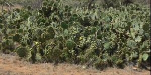
- Opuntia engelmannii is an invasive species that threatens the balance and health of ecosystems in Kenya.
- The plant spreads quickly, degrading landscapes and negatively affecting forage sources for wildlife and community livestock.
- Landscape-scale removal of Opuntia is a constant battle for Loisaba Conservancy and others in the region.
- Satellite imagery and AI are highly effective tools for estimating the density of Opuntia across the conservancy, enabling targeted removal efforts and demonstrating impact over time.
- While the analysis found a general increase of 23% in Opuntia across the Loisaba Conservancy landscape, in areas where removal efforts were initiated, Opuntia cover has decreased by 74% between 2021 and 2025.
Objectives
1. Evaluate the suitability of VHR satellite imagery and machine learning algorithms for mapping Opuntia distribution.
2. Conduct comparative analysis to monitor changes pre- and post-Opuntia removal for improved control strategies.
3. Recommend methods for ongoing Opuntia mapping within Loisaba Conservancy. To target control efforts, needed for nature to thrive.
Introduction
Loisaba is a 58,000-acre conservancy in Laikipia County. Dedicated to wildlife and ecological conservation, Loisaba is home to a diverse array of species, including elephants, giraffes, lions, black rhinos, wild dogs and leopards. For over 30 years, Loisaba has played a key role in supporting local communities, creating more than 450 jobs, developing schools and healthcare clinics and providing managed grazing access for local pastoralists.
Prickly pear cactus (genus Opuntia) encroachment has significantly increased on Loisaba’s rangelands and other semi-arid areas of Kenya over the past several decades. Both woody plant and prickly pear encroachment in these areas have negatively impacted forage availability for livestock. Opuntia is a noxious species that increases soil erosion and decreases grazable grass abundance, affecting sustainable livestock production on these landscapes. Harvesting this invasive species as livestock fodder, especially during dry seasons, leads to the attachment of glochids on livestock skin and gastrointestinal tracts, causing injuries, reduced milk production and even death. The mechanical burning of cactus spines is recommended to reduce injury to the lips, upper gastrointestinal tract and mouth.
Some of the threats Opuntia species cause to biodiversity and ecosystems include reduced foraging, reduced livestock yields, negative impact on wildlife habitats and depletion of soil and water resources, as well as reducing the diversity of plants and animals (Githae 2018).
1a  1b
1b 
Figure 1: a) Invasive Opuntia Engelmanni threatening the Loisaba ecosystem, b) Livestock forced to forage on invasive Opuntia Stricta due to degraded pasture in Naibunga community
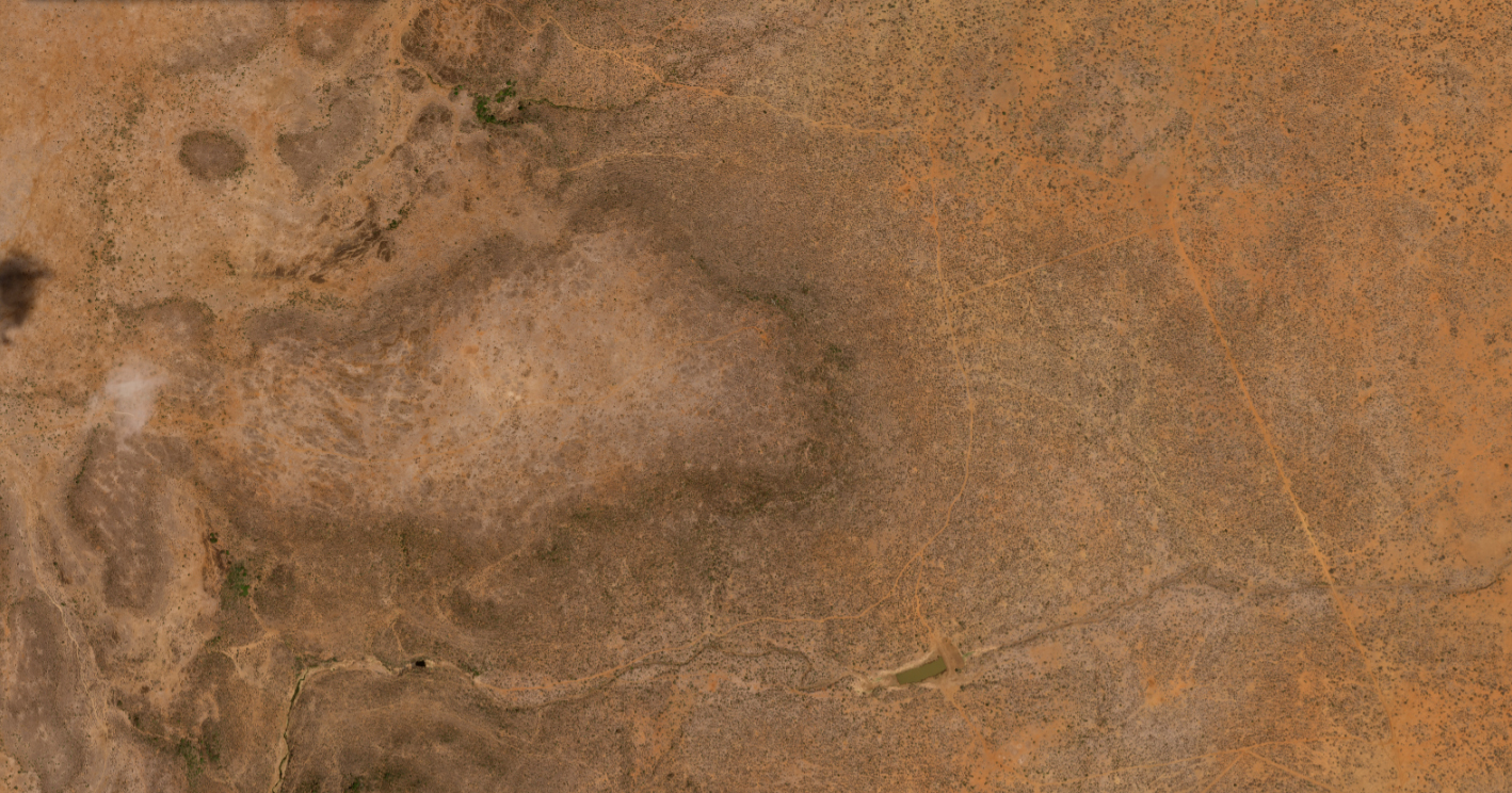
The Study Area
Loisaba conservancy lies in Northern Kenya between 0 30’ 00’’ - 0 41’ 46’’ N and 36 45’ 00’’ - 36 55’ 00’’ E. The conservancy covers approximately 23,588 Ha with an elevation gradient ranging from 1438 m to 1862 m above mean sea level. The 10-year mean annual rainfall (PRISM Climate Group, 2018) is 534 mm, with peak rainfall occurring during April (206 mm/month) and November (192 mm/month). The study area lies east of the conservancy, covering 17,431 Ha, approximately 174 km2.
Data
The data used in this study consisted of satellite imagery from Maxar and Airbus, along with other relevant geospatial datasets. The table below provides a detailed description of the datasets utilised in the analysis.
Table 1: Data description
|
Data |
Description |
Source |
|
World View imagery |
79 scenes at 15 cm resolution and 2 scenes at 30 cm resolution covering 497 km2 were captured in March 2021. Only the 30 cm imagery was used in the study |
Maxar Technologies (Astraea’s EarthAI Demand) |
|
Airbus Pleiades Neo imagery |
2 scenes covering 236 km2 captured in March 2023 at 30 cm resolution |
Airbus OneAtlas |
|
Airbus Pleiades Neo imagery |
2 scenes covering 236 km2 captured in March 2025 at 30 cm resolution |
Airbus OneAtlas |
|
Ground truth points |
258 opuntia class sample points collected from the field |
Loisaba conservancy |

Table 2: Examples of imagery used in the study
Analysis
The analysis was conducted in Google Earth Engine using supervised classification methods. Two machine learning algorithms, Random Forest (RF) and Support Vector Machines (SVM) model, were tested and employed to classify the satellite images into three categories: Other (bare, builtup, water), Trees and Opuntia. Although the unsupervised classification method was tested, it did not produce satisfactory results, leading to the selection of supervised classification as the most effective approach. The parameters used for Random Forest and Support Vector models are presented in Table 3 below.
Table 3: Random Forest and Support Vector Machines model parameters
|
Model |
Parameter |
Value |
| Random Forest | Number of trees | 20 |
| Max features | 4.5 | |
| Support Vector Machines | Regularisation C | 1 |
| Gamma | Scale |
Grey Level Co-occurence Matrix (GLCM) texture features, including contrast, variance, entropy, and dissimilarity, along with NDVI, VARI and ExG vegetation indices, were computed and incorporated as additional bands to enhance the detection of Opuntia.
Results
Classification accuracy
For the classification of the 2021, 2023, and 2025 imagery, the Support Vector Machine (SVM) model outperformed the Random Forest (RF) model in both 2023 and 2025. In 2025, SVM achieved a top accuracy of 97%, compared to 87% for RF. Similarly, in 2023, SVM reached an accuracy of 94%, outperforming RF at 91%. However, in 2021, the RF model performed better, attaining 96% accuracy compared to 93% for SVM.

Figure 2: An example of a raw image (left) and a classified image (right) showing detected Opuntia in pink colour

Figure 3: Classified maps for a) 2021 b) 2023 and c) 2025 showing other (bare, built-up and water) in burnt orange, Trees in green, and Opuntia in lime yellow colour
Opuntia density
The density of Opuntia at Loisaba Conservancy was estimated using centroid mapping and opportunistic sampling. To improve visualisation and minimise clustering of points within dense clumps, buffers were applied, resulting in an estimated density of over 1 million plants.
Opuntia invasion is most prominent in the eastern and central parts of the conservancy, while its presence in the western region remains minimal.
The analysis shows a general increase in Opuntia density across Loisaba Conservancy between 2021 and 2025 of approximately 23%. However, in areas where targeted removal efforts were initiated in 2021, a notable decrease in Opuntia density is observed, highlighting the positive impact of ongoing management and removal interventions.
Figure 4: Opuntia density in Loisaba conservancy in a) 2021 b) 2023 and c) 2025
Opuntia Removal
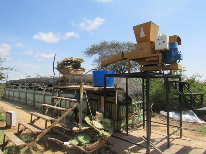
Figure 5: A biogas digester
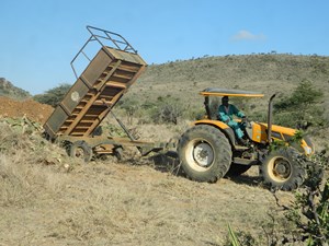
Mechanical removal
Opuntia invasion is estimated to cover approximately 20% of the Loisaba Conservancy. Since 2017, more than 3,000 acres have been cleared of Opuntia, with removal efforts still ongoing. Currently, an average of 50 acres is being cleared each month. The mechanical removal process involves the use of a JCB backhoe to uproot Opuntia clumps, which are then loaded onto tractor trailers. The uprooted plants are transported to pre-dug disposal pits, where they are buried and covered with compacted soil to prevent regrowth. Some plants are used for biogas production.
Biological removal
Since 2021, Loisaba Conservancy has been using biological control to manage Opuntia engelmannii. By the end of March 2025, 16,006 cladodes infected with the Cochineal beetle (Dactylopius opuntia) had been released across 10 targeted sites.
The beetle, which feeds specifically on Opuntia engelmannii, was selected after rigorous scientific testing, led by the Centre for Agriculture and Bioscience International (CABI) and approved by the Kenya Plant Health Inspectorate Service (KEPHIS). Releases were carried out within established 50 m x 50 m transects, where monthly monitoring tracks beetle spread and effectiveness.
Greenhouses for biological control multiplication have been established at Loisaba and within Naibunga lower community.
By May 2023, monitoring reports showed the Cochineal beetle had successfully established across significant parts of the Loisaba ecosystem. The biological control has dramatically reduced Opuntia density within targeted areas.
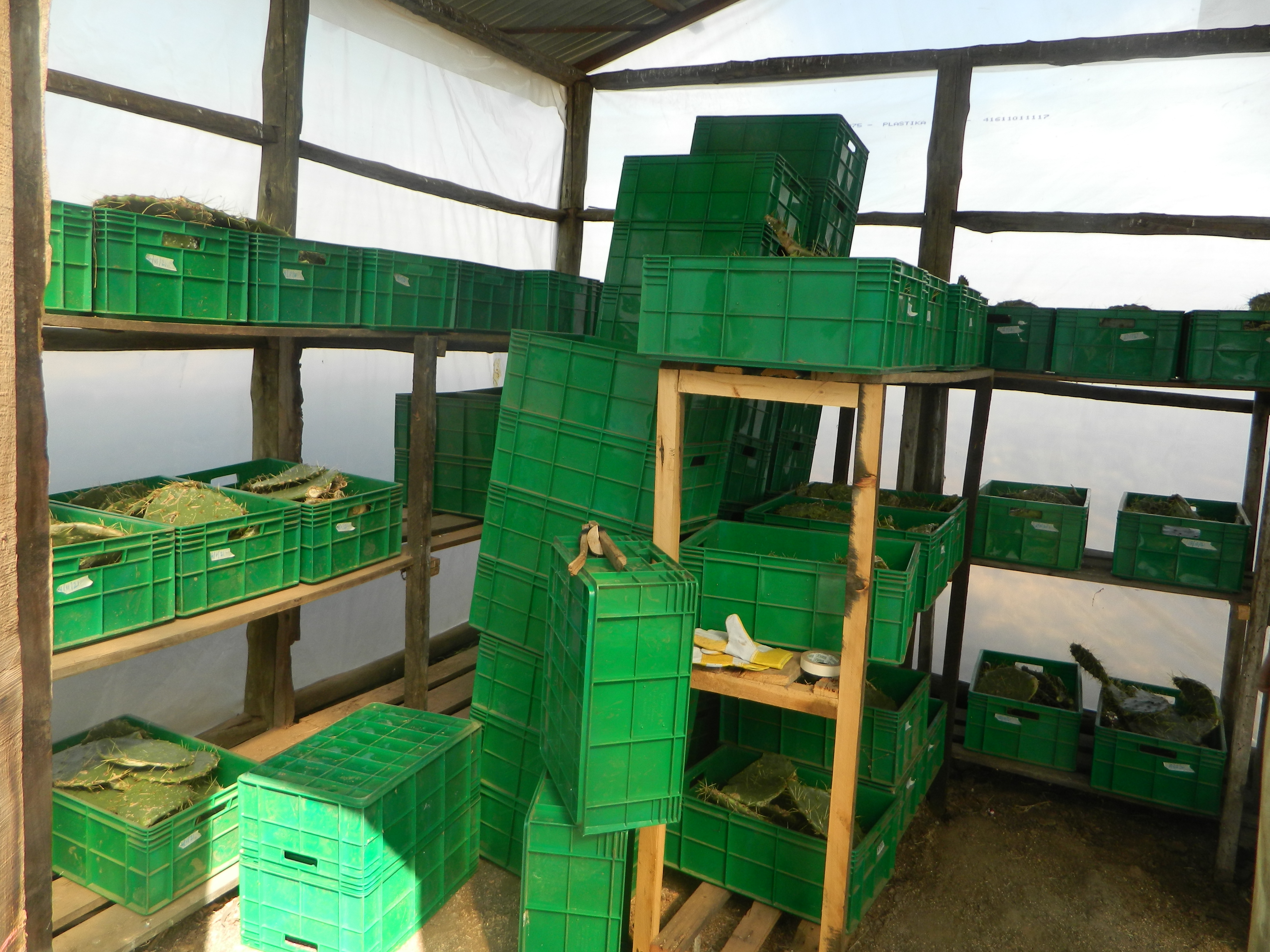
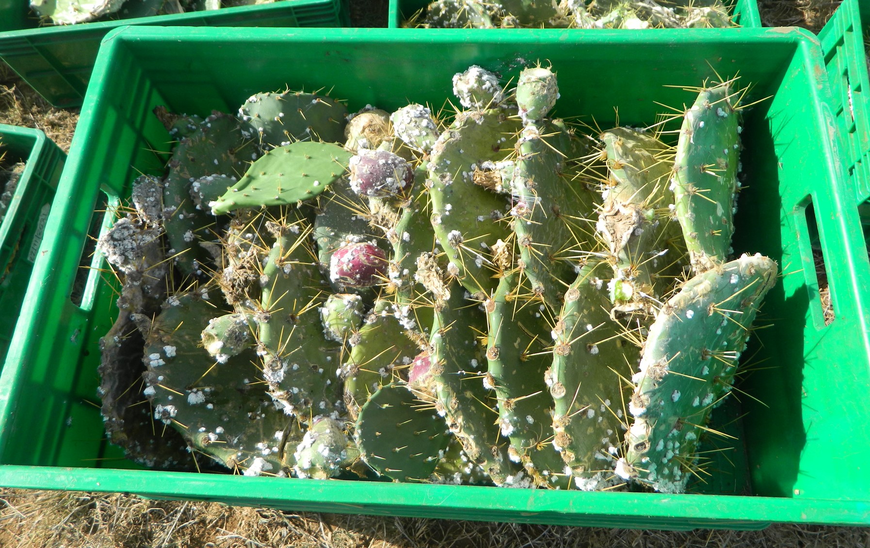
Figure 6: Cochineal infection and greenhouse multiplication
Change detection
A temporal analysis of classified maps from 2021, 2023 and 2025 was conducted to assess changes in the distribution of Opuntia within the study area. In 2021, the area covered by Opuntia was approximately 69.7 hectares. By 2023, this had declined to 31.9 hectares, representing a reduction of about 54.2%. The downward trend continued, with the Opuntia cover further decreasing to 18 hectares in 2025. Overall, between 2021 and 2025, the total area under Opuntia decreased by approximately 74.2%.
This significant decline is attributed to the active Opuntia removal efforts that were initiated in 2021. The sustained management and eradication measures implemented over the four-year period have played a key role in substantially reducing the presence of this invasive species in the conservancy. Figure 6 below shows Opuntia density in one of the areas targeted for removal.
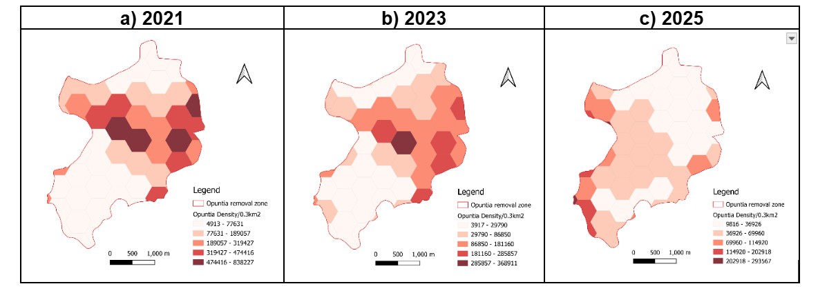
Figure 7: Opuntia density/0.3 km2 in the removal area
Challenges and limiting factors
- Some imagery was captured during the wet–dry season transition when Opuntia is less distinguishable from other vegetation. To improve accuracy and avoid overestimation, satellite image acquisition should target peak dry seasons when Opuntia is more visible, enhancing detection, cover and density estimates.
- The ground-truth sample points used to train the algorithms were collected only from areas with an unobstructed view of the sky. As a result, Opuntia growing beneath dense vegetation, such as tall trees, may not have been detected, potentially leading to underestimation in areas with significant canopy cover.
- For future analysis, transects should be used to validate Opuntia density estimates, particularly in escarpments and densely vegetated areas where satellite detection is limited.
- Boscia tree (> 3m) has almost similar reflectance to Opuntia. Tree height DSM models or DSM must be used to eliminate all vegetation above 3 m. Opuntia is less than 3 m.
Conclusion
The Loisaba team aims to eliminate Opuntia from the conservancy within the next five years, with long-term plans implementing the monitoring and control of any new invasions. Early analysis shows improved native vegetation recovery and increased wildlife use in rehabilitated areas. Moving forward, Loisaba aims to document and share its experiences, particularly around the effectiveness of mechanical removal methods through detailed write-ups, community engagement meetings and technical workshops, contributing to broader knowledge exchange on invasive species management. Through these efforts, Loisaba seeks to restore its landscapes and support neighbouring conservancies and communities in developing effective invasive species control strategies.
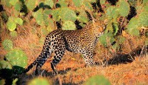
Loisaba conservancy
Loisaba is home to a diverse array of species, including elephants, giraffes, lions, black rhinos, wild dogs and leopards. For over 30 years, Loisaba has played a key role in supporting local communities, providing grazing access for pastoralists.